Lumen8
Home Utility Scale Rural Electrification Modules
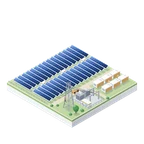
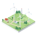
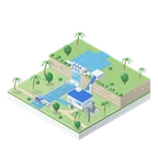
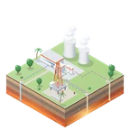
Utility Wind Hydro Geothermal Village Behavioural Twin Agri Agrivoltaics Aqua Hydroponics Telco Marine Supply Chain Portfolio Jarvis
Investors Platform Request access
Sustainable development platform

Infrastructure for a
sustainable world.

Lumen8 turns a point on a map into a bankable project for clean power, energy access, food, water and connectivity. Fifteen modules on one engine: screened, engineered, financed and verified in minutes.

SCROLL
Clean powerEnergy accessFood securityWaterConnectivityClimate actionFeasibilityEngineeringFinancingProcurementVerificationCarbon ledgerImpact measurementDigital twin
What we do

Fifteen modules.
One platform for sustainable development.

Each module is a full workspace with its own data, models and exports, on the same engine, so a village, a wind farm, a port and a farm are screened, designed, financed and verified the same way. Turn the dial.

Studies that took months now take minutes. And they arrive with the drawings, the numbers and the paperwork.

01 · LOCATE

Start with a point.

A coordinate, a village name or a drawn boundary. That is the whole input. Everything else is derived.

02 · SENSE

Read the site from orbit.

Satellite imagery, building footprints, terrain, solar resource, grid proximity, hazards and climate projections are fused into one profile.

03 · DESIGN

Engineer it properly.

Layout, electrical design, storage sizing and code checks run automatically. The result is a drawing set an engineer can open in CAD.

04 · FINANCE

Make the numbers bankable.

Cost, tariff, yield and risk become a financial model. Scenarios, sensitivities and funding stacks are generated alongside it.

05 · DELIVER

Hand over the full pack.

A fourteen-tab engineering pack, the drawing set in DXF, the financial model, the bankable dossier, grant drafts, the carbon ledger and an offline field pack: all from the same run, all traceable to their sources.

Proving ground

Built on a whole country.
Not a demo dataset.

Lumen8 was proven across Indonesia, the hardest archipelago on Earth to electrify. Every module carries national-scale data with its provenance attached.

0Villages indexed and screenedRural electrification
0Port facilities mappedMaritime
0Tower sites scored for solarTelecoms
0Hectares of agricultural land classified by cropAgriculture
203,708kmGrid network predicted
10Stage utility pipeline
14Tab engineering pack
170Sourced component SKUs
12Funding instruments
1,785MWeAcross 8 geothermal fields Early access
Measured against the goals

Twelve goals.
One ledger of evidence.

The world has already agreed what sustainable development means: seventeen Sustainable Development Goals. The modules land on twelve of them directly, and every result is reported from the same run that designed and priced it, so impact is counted, not claimed.

01SDG 1 · 2 modules

No poverty

Power for the villages the grid has not reached, and the livelihoods measured after it arrives.

02SDG 2 · 4 modules

Zero hunger

Crops read from orbit, farms that grow under solar, and fish and greens farmed with the energy they need.

06SDG 6 · 2 modules

Clean water and sanitation

Catchments modelled from terrain and rain, and water use designed into every growing system.

08SDG 8 · 3 modules

Decent work and economic growth

Livelihoods modelled and measured, and the mills, pumps and cold stores sized into the design.

09SDG 9 · 5 modules

Industry, innovation and infrastructure

Towers, ports and supply chains planned as infrastructure, with the engineering to build them.

10SDG 10 · 1 module

Reduced inequalities

Impact measured household by household against a counterfactual, not averaged away.

12SDG 12 · 2 modules

Responsible consumption and production

Equipment priced, sourced and shipped from factory to site with its landed cost laid bare.

14SDG 14 · 2 modules

Life below water

Shore power for ports, and aquaculture sized to the water it depends on.

15SDG 15 · 2 modules

Life on land

Land shared between food and power, and deforestation screened before anything is built.

17SDG 17 · 2 modules

Partnerships for the goals

Evidence a lender, a government and a community can all sign: one source of truth.

Goal mapping by Lumen8. The Sustainable Development Goals are the United Nations'; no endorsement is implied.

Who it is for

Three readers.
One source of truth.

DEVELOPERS & EPCs

Win the site before anyone else has studied it.

Screen a portfolio in an afternoon, then take the best sites straight to engineering.

  • Ranked pipelines from a whole region
  • Engineering packs and CAD drawings
  • Bill of materials with sourced components
GOVERNMENTS & AGENCIES

Turn a masterplan into a build order.

See every candidate on one map, with cost, impact and grid arrival timing side by side.

  • National coverage with honest data badges
  • Grant and programme applications drafted
  • Impact mapped to the goals, not asserted
CAPITAL, DFIs & INSURERS

Underwrite from evidence, not slides.

Every figure traces to its source. Every run is reproducible. Every risk is on the register.

  • Bankable dossiers and disclosure reports
  • Climate, hazard and political risk fused
  • Aggregate small sites into fundable portfolios
A first engagement

From your first email
to a signed dossier.

Most first engagements run in weeks, not quarters. Nothing is built in the abstract: every step runs on your own sites, and you keep every output.

01 · SCOPE

Tell us what you need to decide.

A region to screen, a boundary to design, a portfolio to underwrite. We agree the question, the offtake and who has to sign at the end.

You bring · sites, constraints, the decision
02 · SCREEN

Rank everything, twin the shortlist.

The whole region is screened and ranked. The best candidates are rebuilt in 3D from satellite and sized hour by hour, so the shortlist is a set of designs, not a list of names.

You get · a ranked list with its reasons
03 · DESIGN

Engineer the ones that matter.

Layout, electrical design, code checks, an itemised bill of materials and the financial model, with every assumption stated and every figure traced to its source.

You get · drawings, workbook, model
04 · HAND OVER

Walk it through with your engineers.

A dossier per site, reviewed with the people who will build it and the people who will fund it. Then the sites go into the field, and the satellites keep watching.

You keep · every file, every run
What comes out

An engineering pack,
and documents people can sign.

Not a PDF and a spreadsheet. The full pack an engineer, a lender and a field crew each need, from one run, in the formats their tools already open.

For the engineer
XLS
Engineering packFourteen tabs, site to storage to cost
DXF
Drawing setLayouts, single-line, schedules
XML
Civil surfacesLandXML for earthworks and roads
3D
Site modelAs-built, on real terrain
For the lender
PDF
Bankable dossierFinancials, technical, risk
XLS
Financial modelScenarios and sensitivities
PDF
Executive briefingEight pages, decision-ready
For the approval
DOC
Grant application draftPre-filled from the run
PDF
Climate disclosureHazard and transition risk
PDF
Carbon verificationSatellite-checked, annual
For the crew on site
KIT
Field briefingOffline pack for site teams
The pack
Why it can be trusted

Honest
by design.

A platform that decides where money goes has to show its working. Lumen8 is built so that nothing can quietly pretend to be better than it is.

01

Every number carries its source

Each dataset is stamped with where it came from and how fresh it is. Real, modelled and placeholder data are labelled differently on screen.

02

Every run is reproducible

The same inputs give the same outputs, and each run is hashed so a reviewer can confirm the document they hold matches the analysis that produced it.

03

Every design is checked against code

Electrical designs run through standards-based rule sets before they leave the platform. Failures are reported, not hidden.

04

Every claim is verifiable from orbit

Built assets are re-observed by satellite so impact and carbon are measured against what actually exists on the ground.

Questions

Before you
write to us.

The things people ask in the first call, answered plainly. Anything else, ask.

What makes it a sustainable development platform?

It covers the infrastructure sustainable development actually runs on: clean power, energy access, food, water, connectivity and trade, on one engine and one standard of evidence. Every module designs, prices and finances its asset, every design carries its carbon ledger, and every result states which goals it serves and how that was measured.

What do we need to send you to start?

A coordinate, a boundary as KML or GeoJSON, or a list of sites. For a region, a province name is enough. If you have a target capacity, an offtake in mind or a lender's requirements, send those too and the run is shaped around them.

How long does a run take?

Screening a region is a matter of minutes. A full engineering and financing case for one site runs in under an hour of compute. The time that matters is the review with you, which is a working session, not a project.

Where does the data come from?

Satellite imagery, building footprints, terrain, decades of reanalysis weather, grid maps, hazard and climate models and national statistics, from public and licensed sources. Every value on screen is stamped with its source and its date, and modelled or placeholder data is labelled as such.

Does it replace an engineer?

No. It produces what an engineer would otherwise spend weeks assembling, with code checks and a review trail, so their time goes into judgement instead of collation. The pack is built to be checked, and it says what it assumed and what it could not do.

Which countries does it cover?

The platform was built and proven on Indonesia. The utility-scale and agrivoltaics engines run anywhere on Earth with the grid code and currency chosen explicitly; wind covers Southeast Asia; hydro starts with Indonesia. Country coverage for the village, port, tower and agriculture modules is extended by request.

How do we get access?

By engagement. Tell us what you are trying to decide and we will propose a pilot on your own sites. If it earns its place, it becomes a seat on the platform for your team.

Request access

See it run on a site you care about.

Send us a coordinate, a boundary or a portfolio. We will run it through the engine and walk you through the result.